
Outer Banks, NC
Rodanthe Homes For Sale
The northernmost village on Hatteras Island, in Dare County, where NC-12 comes off the Rodanthe Bridge. The 2020 census counted 213 residents. The ZIP code is 27968, and the Chicamacomico Life-Saving Station is on the highway.
Post office 1874
Established
213
2020 Census
Dare County · Hatteras Island
County
On The Map
Where Rodanthe sits on the Outer Banks.
31 mi
Wright Brothers National Memorial
as the crow flies
66 mi
Elizabeth City
as the crow flies
98 mi
Norfolk, VA
as the crow flies
Distances are straight-line (“as the crow flies”), not driving times.
Live Listings
Homes for sale in Rodanthe.
Real-time listings from the MLS, updated around the clock and scoped to Rodanthe, NC.
IDX listings are provided by the Outer Banks Association of Realtors and HIVE MLS. Data is deemed reliable but not guaranteed.
A Local's Perspective
Life in Rodanthe.
Rodanthe is an unincorporated community and a census-designated place at the north end of Hatteras Island in Dare County, the first village south of Pea Island National Wildlife Refuge. Waves and Salvo are next, and the three share the old Chicamacomico name. NC-12 runs through the houses, with the Atlantic on the east and Pamlico Sound on the west. Wikipedia puts the census-designated place at about 0.96 square miles of land. The 2020 census counted 213 people and 81 households. The ZIP code is 27968. There is no town hall. Dare County covers the village, in commissioner District 4 with the other Hatteras Island villages.
The North Carolina Gazetteer lists the older name as North Rodanthe and says a post office here operated as Chicamacomico until 1874, when it took the name Rodanthe. Waves uses ZIP 27982 and Salvo uses 27972. Read the city on the sheet. The census line is small, and a house filed under the MLS city can sit outside it. The listings on this page follow the MLS city.
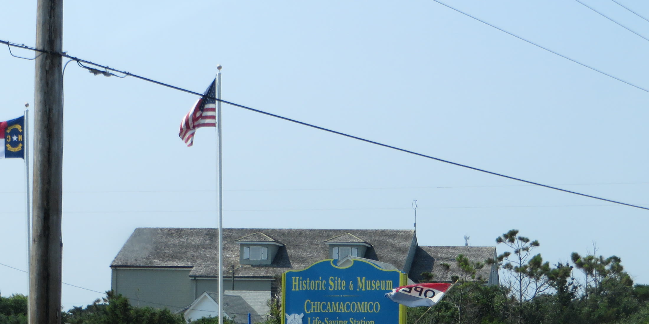
The Chicamacomico Life-Saving Station stands on the east side of NC-12. Wikipedia dates it to 1874, records National Register reference 76000164 added on December 12, 1976, and says the Coast Guard used it until 1954. It is a museum now. The station site gives the address as 23645 N.C. Highway 12, at milepost 39.5, and lists hours of Monday through Friday, 10 a.m. to 5 p.m., closed Memorial Day, Independence Day, and Labor Day. Wikipedia dates the rescue of the British tanker Mirlo to August 16, 1918, and says the crew saved 42 people.
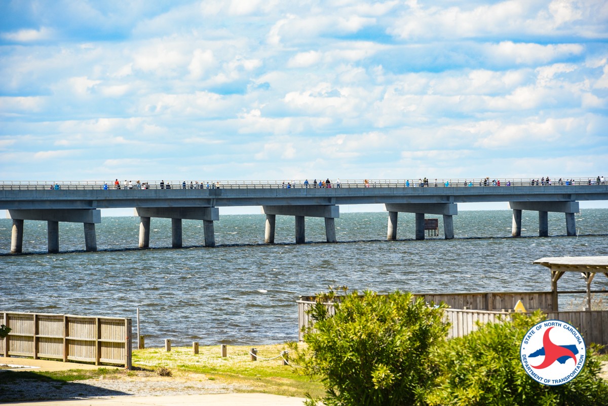
The drive from Nags Head crosses Oregon Inlet on the Marc Basnight Bridge, then Pea Island, then the Rodanthe Bridge. Coastal Review, quoting NCDOT, describes that bridge as 2.4 miles over Pamlico Sound, from the south end of the refuge to the north end of the village. It opened to vehicles on July 28, 2022, and it carries NC-12 around the S-curves. On November 19, 2026 the MLS city filter returned 48 active house, condo, and townhouse rows: 29 city Rodanthe and ZIP 27968, 11 city Salvo, and 8 city Waves. Sale prices move with the MLS.
Rodanthe is part of Southern Beaches. That page covers the rest of the town around this community.
At A Glance
- Established
- Post office 1874
- 2020 Census
- 213
- County
- Dare County · Hatteras Island
- HOA Norm
- Mixed
Highlights
What defines Rodanthe.
The north end of Hatteras Island
Rodanthe is the first village south of Pea Island. Waves and Salvo are next, then Avon. The 2020 census counted 213 people on about 0.96 square miles of land.
A post office name since 1874
The North Carolina Gazetteer says the post office operated as Chicamacomico until 1874, then became Rodanthe. The older name for the place was North Rodanthe. The county covers the village.
Chicamacomico Life-Saving Station
The station is at 23645 N.C. Highway 12. It was built in 1874, listed on the National Register in 1976, and used by the Coast Guard until 1954. The site now lists weekday museum hours.
The Rodanthe Bridge
NCDOT opened the 2.4-mile bridge to cars on July 28, 2022. It carries NC-12 over Pamlico Sound and around the S-curves between Pea Island and the north end of the village.
Neighborhoods
Where to look in Rodanthe.
Along NC-12
The highway is the spine once you leave the bridge. A house on the highway, a house one street back, and a house with a path to the beach are different products. The life-saving station is on the east side of the highway at milepost 39.5. Ask which lot the listing is before you compare prices.
Oceanside and soundside
The MLS codes many Rodanthe rows RODANTHE OCEANSIDE or RODANTHE SOUNDSIDE. That label says which side of the highway the row is filed on. It is not, by itself, an association, and it is not a promise of a deeded shoreline. On November 19, 2026 one Rodanthe-city row was coded WAVES SOUNDSIDE. Read the city and the street.
Lifestyle
Around Rodanthe.
Days here follow NC-12, the sound bridge at the north end, and the ocean and Pamlico Sound on either side of a narrow island. The Buxton campuses and the Cape Hatteras Lighthouse are a drive south.
The Rodanthe Bridge, 2.4 miles over Pamlico Sound, opened to vehicles on July 28, 2022.
Chicamacomico Life-Saving Station at 23645 N.C. Highway 12, milepost 39.5.
Pea Island National Wildlife Refuge, the land north of the bridge.
Cape Hatteras National Seashore, which borders the Chicamacomico villages on the south.
Waves and Salvo, the next villages south on NC-12, then Avon.
Cape Hatteras Elementary and Cape Hatteras Secondary, both in Buxton.
Schools
Schools serving Rodanthe.
Part of Dare County Schools.
Elementary
- Cape Hatteras Elementary School
Grades 6–12
- Cape Hatteras Secondary School
There is no school in Rodanthe. The attendance-zone page, fetched November 19, 2026, assigns both Cape Hatteras campuses to all areas south of the Oregon Inlet Bridge. The elementary contact page lists 47500 Middle Ridge Road, Buxton, and the district directory lists that campus as 47500 Middle Ridge Trail. The secondary school lists 48576 Hwy 12, Buxton. Confirm the current zone for a specific address.
School attendance zones are address-specific and change over time. Always verify enrollment eligibility directly with the district before making a purchase decision.
HOAs & POAs
Rodanthe HOA norms
Rodanthe has no village-wide association. Most housing is on individual lots. Some streets have recorded rules, and many houses do not. The MLS names Rodanthe Oceanside and Rodanthe Soundside describe which side of NC-12 the row is on. They are not, by themselves, an association. Ask for the current resale documents on that house before you compare it with a gated community farther north.
New Construction
Building in Rodanthe
New houses go through Dare County permits. On November 19, 2026 none of the active Rodanthe-city rows were flagged new construction, and the years built on the rows that had one ran from 1984 to 2022. The refuge to the north and the national seashore to the south limit how far the village can spread. Confirm flood zone, septic or sewer, setbacks, and any association review on the lot in front of you. Ocean overwash can still close NC-12 even with the bridge in place.
Keep Exploring
Communities near Rodanthe.

Straight Answers
Rodanthe buyer questions, answered.
Where is Rodanthe?
Rodanthe is an unincorporated village at the north end of Hatteras Island in Dare County. Pea Island National Wildlife Refuge is to the north. Waves and Salvo are the next villages south. The ZIP code is 27968. The 2020 census counted 213 people on about 0.96 square miles of land. There is no town hall. Dare County covers the village, in commissioner District 4 with the other Hatteras Island villages. Wikipedia calls this the easternmost point of North Carolina.
Is Rodanthe the same as Waves or Salvo?
No. The three villages share the old Chicamacomico name, and they sit one after another on NC-12, but they are different places. The North Carolina Gazetteer says Rodanthe was formerly North Rodanthe and that its post office changed from Chicamacomico to Rodanthe in 1874. Waves uses ZIP 27982. Salvo uses 27972. Read the city on the listing. On November 19, 2026 a search for the city of Rodanthe also returned Waves and Salvo rows.
Which schools serve Rodanthe?
Dare County Schools. The attendance-zone page assigns Cape Hatteras Elementary and Cape Hatteras Secondary to all areas south of the Oregon Inlet Bridge. Both campuses are in Buxton, not in Rodanthe. The elementary contact page lists 47500 Middle Ridge Road. The district directory lists 47500 Middle Ridge Trail for that school. The secondary school lists 48576 Hwy 12. Confirm the street with the district. The drive from the village is NC-12 south.
What is the Rodanthe Bridge?
It is the NC-12 bridge over Pamlico Sound between the south end of Pea Island National Wildlife Refuge and the north end of the village. Coastal Review, quoting NCDOT, gives the length as 2.4 miles and the vehicle opening as July 28, 2022. The bridge carries the highway around the S-curves, the ocean-side stretch that used to wash out. A house in the village is not a house on the bridge. Read the lot's own survey and flood zone.
Do Rodanthe homes have association dues?
It depends on the house. There is no Rodanthe-wide association. The MLS names Rodanthe Oceanside and Rodanthe Soundside say which side of NC-12 the row is on. They are not, by themselves, an association. Ask for the resale package on that house, and ask whether the lot is on the ocean, on the sound, or on neither, before you write an offer.
How do I see Rodanthe homes for sale?
The listings section on this page pulls active MLS homes filtered to the city of Rodanthe. On November 19, 2026 that filter returned 48 house, condo, and townhouse rows: 29 filed as Rodanthe and ZIP 27968, 11 as Salvo, and 8 as Waves. Read the city and the street on each row. The feed follows the same house, condo, and townhouse scope as the other community pages, so a vacant lot may not appear there. Inventory changes daily. Call The Spencer Team if you want a walkthrough of a specific house, dock, or setback.
Make Your Move
Ready to find your Rodanthe home?
Buying or selling in Rodanthe — Sarah and The Spencer Team know it block by block. One call away.